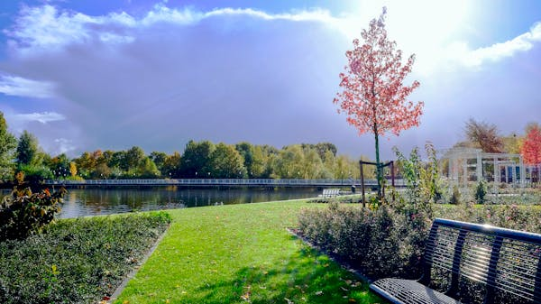
Drone solutions for landscape architecture projects help design teams document a site from above, map terrain, review vegetation, create 3D context, and monitor construction without relying only on ground photos or slow manual walkthroughs.
- What drone solutions do landscape architects use?
- Drone workflow by landscape project stage
- Why Landscape Architects Need Drone Technology
- Essential Drone Applications for Site Analysis
- Advanced Mapping and Surveying Techniques
- Design Visualization and Client Presentations
- Construction Monitoring and Progress Tracking
- Flight planning and compliance notes
- Choosing the Right Drone Equipment
- Drone solutions for landscape architecture FAQ
- What are drone solutions for landscape architecture projects?
- How do drones help with landscape site analysis?
- Can drone mapping replace a licensed land survey?
- What drone data is most useful for landscape architects?
- Do landscape architects need FAA approval to use drones?
- Where should drone images fit into a client presentation?
- What is the biggest mistake when using drones in landscape architecture?
- Using drone data without losing the design intent
- More architecture and landscape planning resources
What drone solutions do landscape architects use?
Landscape architects use drones for aerial site photography, topographic mapping, orthomosaic imagery, vegetation review, photogrammetry-based 3D models, LiDAR-assisted terrain scans, and repeat construction monitoring.
The best workflow starts with a design question: What does the team need to understand before drawing or approving the next move? A drone flight can reveal drainage patterns, slope changes, canopy gaps, access problems, and construction progress faster than ground photos alone. For professional work, drone data should be paired with field notes, survey control when accuracy matters, and a flight plan that respects airspace, people on site, weather, and local permissions.

Drone workflow by landscape project stage
| Project stage | Drone output | Design decision it supports |
|---|---|---|
| Existing conditions | Aerial photos and short video passes | Access, views, edges, and site constraints |
| Concept design | Top-down mapping and stitched site imagery | Path layout, planting zones, and drainage logic |
| Technical coordination | Photogrammetry or LiDAR-style terrain data | Grade, slopes, walls, steps, and hardscape tie-ins |
| Planting review | Repeat imagery and vegetation comparison | Stress areas, canopy gaps, irrigation issues, and maintenance priorities |
| Construction | Progress flights from consistent viewpoints | Installed work, sequencing, contractor coordination, and client updates |
| Presentation | Aerial before/after views and 3D context | Clearer client approvals and stronger design storytelling |


Why Landscape Architects Need Drone Technology
The unique challenges of landscape architecture projects surpass the efficiency of traditional ground-based methods. Traditional methods turn into significant obstacles when large sites or challenging terrains need to be worked on within tight deadlines.
Here’s what makes drones essential:
Time savings alone justify the investment. Tasks that required survey crews multiple days or weeks to complete can now be finished in just hours. Traditional survey methods require a full week for 50-acre sites but the proper drone configuration allows completion of the survey within one afternoon.
But it goes deeper than just speed…


Unprecedented Site Access
Reflect on construction projects which require data collection from steep slopes, wetlands, or densely vegetated regions. Deploying survey teams in these environments requires more time than expected and also presents danger and potential impossibility.
Drones eliminate these access barriers completely. Drones provide the ability to hover over marshy areas while navigating tree canopies and gather data from positions that would otherwise need costly helicopter rentals or specialized climbing equipment.
Cost-Effective Data Collection
This fact about drones remains unknown to many landscape architects at the beginning of their careers.
Investing in drone technology quickly generates a return on investment due to its cost efficiency. The return on investment becomes clear when you reduce labor expenses, eliminate equipment rental fees and achieve faster project completion times.
Drone technology allows for the same deliverables to be produced at drastically lower costs while generating far more detailed data.
Enhanced Design Accuracy
High-resolution data accuracy at project start prevents expensive design changes throughout the project timeline. Achieving precision in base maps, elevation models and site analysis from the start enhances both efficiency and reliability throughout your entire design process.


Essential Drone Applications for Site Analysis
Site analysis serves as the essential foundation for all successful landscape architecture projects. Drone technology enables the collection of complete data sets that traditional methods cannot achieve by themselves.
Topographical Mapping and Elevation Data

Generating precise topographical maps was traditionally one of the longest tasks in landscape projects. Surveyors needed to walk through project sites with GPS devices to document measurements at fixed intervals which helped them develop elevation models.
Drones change this completely. One flight operates to gather thousands of elevation points throughout your site and produces high-detail Digital Elevation Models (DEMs) with centimeter-level precision. The data serves as the essential foundation for drainage analysis as well as grading plans and slope calculations.
The time savings are incredible. A task that used to require survey crew work over three days is now accomplishable through a single morning drone flight session.
Vegetation Analysis and Environmental Assessment

The analysis of current plant life stands as an essential component for creating sustainable landscape designs. Multispectral camera-equipped drones have the ability to detect plant species and evaluate their health while mapping vegetation density throughout expansive regions.
The method proves particularly beneficial for restoring habitats as well as managing urban forests and identifying invasive plant species. AI-powered autonomous systems in drones are improving operational efficiency across agriculture and construction fields.
Landscape architects face water management as their primary complex challenge. Drones prove highly effective in detecting drainage patterns and potential flood risks that remain hidden when observed from the ground.


Advanced Mapping and Surveying Techniques
Contemporary drone surveying techniques extend much further than taking basic photographs. Today’s US-made drones come equipped with sophisticated sensors that can capture data invisible to the human eye.
LiDAR Integration for Precision Measurements

LiDAR technology has revolutionized landscape architecture by enabling precise work in challenging environments. LiDAR technology surpasses traditional photogrammetry by enabling penetration through vegetation canopies to collect ground surface information.
With this technology you can create detailed topographic maps of forested terrain and capture accurate elevation data even in heavily vegetated areas. Any project aiming to restore or develop wooded areas requires this capability for successful execution.
Photogrammetry for 3D Model Creation

Detailed 3D models of your site come from hundreds of overlapping photographs through photogrammetry. These models serve as accurate measurement devices which enable volume calculations and distance measurements while providing site analysis from multiple perspectives.
The best part? You can import these 3D models directly into your design software which transforms your data collection process into a seamless design development workflow.
Design Visualization and Client Presentations
Landscape architects find drone technology extremely beneficial because it unlocks new possibilities for their work.
Your client presentations gain dramatic engagement when you present real aerial footage of their site next to your proposed designs. Real drone footage enables you to produce before-and-after visualizations which transform your presentations into highly engaging experiences.
You can build immersive virtual tours by blending existing site conditions with your proposed design elements to present clients with realistic visualizations. Clients can gain a deeper understanding of spatial arrangements and design intentions through this method which traditional plans and renderings fail to deliver.


Construction Monitoring and Progress Tracking

The construction phase of a landscape architecture project makes drones essential for effective project management. The U.S. workforce for drone-related positions is projected to surpass 100,000 by 2025 with many roles dedicated to construction monitoring and site supervision.
Standard construction monitoring depends on site visits together with manual inspections and extensive progress reporting. Real-time aerial views from drones transform construction monitoring procedures. Drones enable rapid identification of potential problems and verification of progress while maintaining stakeholder documentation.
Drone monitoring generates necessary documentation that shows construction projects meet environmental regulations and permit requirements.
Flight planning and compliance notes
For professional drone work in the United States, plan the flight before you plan the shot list. The FAA explains that commercial drone operations generally fall under rules for certificated remote pilots and commercial operators. Teams should also review the FAA’s UAS getting started guidance and check whether controlled airspace requires authorization through LAANC. This matters for landscape architecture because project sites often sit near roads, schools, waterfronts, event spaces, airports, construction crews, or private property edges.
A practical preflight checklist should cover the design purpose, airspace, site permission, nearby people, weather, battery plan, landing zone, data format, and how the imagery will be used after the flight. If the output needs legal boundary accuracy or construction-grade control, involve a licensed survey professional instead of treating a drone map as a replacement survey.
Choosing the Right Drone Equipment
The choice of drone equipment depends on both project needs and budgetary limits. The enactment of the 2024 FAA Reauthorization Act will result in heightened demands for Beyond Visual Line of Sight (BVLOS) drone operations that will notably affect commercial drone activities.
Select drones that feature high-resolution cameras and precise GPS mapping capabilities along with durable weather resistance and extensive flight durations, and ensure they come with user-friendly flight planning software.
The reliability and precision needed for landscape architecture projects are characteristics commonly found in professional-grade surveying drones. Select a system that operates seamlessly with your current design software and established workflow processes.
Drone solutions for landscape architecture FAQ
What are drone solutions for landscape architecture projects?
Drone solutions for landscape architecture projects include aerial photography, orthomosaic mapping, photogrammetry, LiDAR-assisted terrain scans, vegetation review, and construction progress monitoring. The goal is not just prettier aerial images; it is faster site reading, clearer measurements, and better communication between designers, clients, consultants, and contractors.
How do drones help with landscape site analysis?
Drones help site analysis by showing the full relationship between slope, paths, vegetation, water movement, access points, and adjacent buildings. A short flight can reveal patterns that are easy to miss at ground level, especially on large, wooded, sloped, or partially built sites.
Can drone mapping replace a licensed land survey?
Drone mapping is useful for design studies, progress checks, and visual documentation, but it should not automatically replace a licensed survey. Boundary work, legal documents, and high-accuracy construction control usually need a qualified survey professional and the right ground control workflow.
What drone data is most useful for landscape architects?
The most useful data depends on the project stage. Early design often needs aerial photos, top-down mapping, and elevation cues. Detailed coordination may need photogrammetry, ground control points, or LiDAR-style terrain capture. Construction phases benefit from repeat flights taken from consistent positions.
Do landscape architects need FAA approval to use drones?
In the United States, business drone work generally needs a certificated remote pilot under FAA Part 107 rules. Teams also need to check airspace, local restrictions, site permissions, weather, and safety planning before flying. The compliance workflow should be set before the first site visit.
Where should drone images fit into a client presentation?
Use drone images where they answer a design question: existing conditions, drainage logic, canopy cover, circulation, construction progress, or before-and-after comparison. Aerial images are strongest when paired with a site plan, section, or 3D model rather than shown as decoration.
What is the biggest mistake when using drones in landscape architecture?
The biggest mistake is flying without a clear design question. Decide what the team needs to learn before launch: grade, plant health, access, drainage, construction status, or presentation context. Otherwise the flight produces attractive images but not much usable design evidence.
Using drone data without losing the design intent
Drone technology is strongest when it sharpens a design decision. Use it to understand grade, water, canopy, movement, and construction progress, then bring that evidence back into the plan, section, model, and client conversation.
Start with simple flights for existing conditions and visual documentation. Move into mapping, photogrammetry, or LiDAR only when the project needs that extra precision. The point is not to make the workflow more technical for its own sake; it is to see the site more clearly and avoid expensive surprises later.
- 20shares
- Facebook0
- Pinterest20
- Twitter0
- Reddit0


