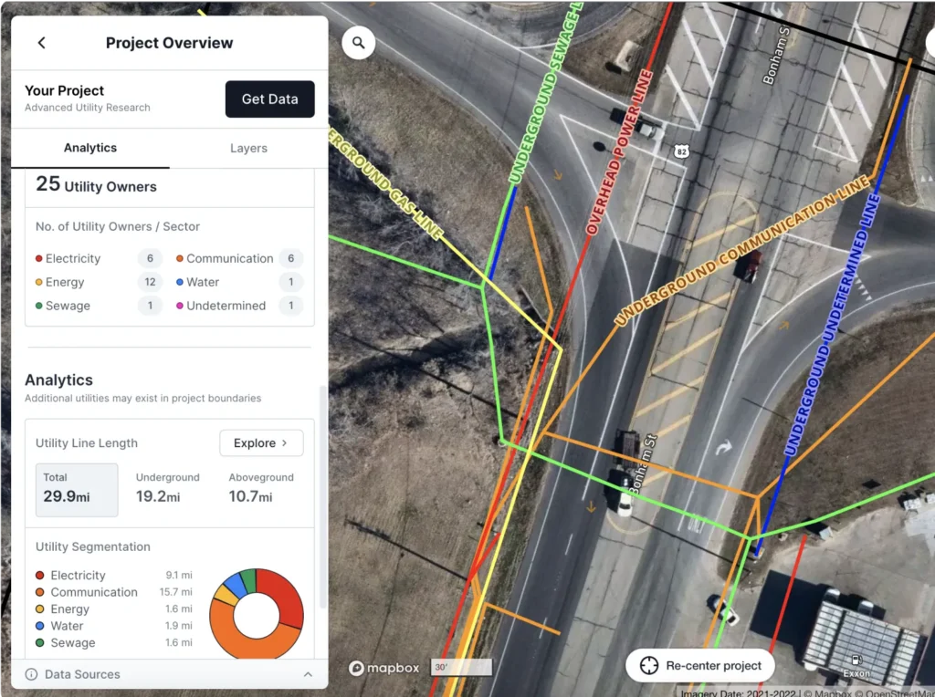

We live in an increasingly urbanised world, so knowing what lies beneath the ground is critical. Imagine a construction team accidentally hitting an unmarked gas line or cutting through fibre-optic cables—these mishaps not only cause delays but also pose significant safety risks. Accurate underground utility mapping is essential for avoiding these situations, ensuring safety, and minimising project costs.
The Importance of Accurate Underground Utility Mapping
Underground utility mapping provides the precise location of buried utilities, helping prevent costly and dangerous errors. Missteps can lead to infrastructure damage, safety hazards, and unnecessary delays, particularly in urban areas where utilities are densely packed. To meet these demands, advanced technology is essential, as conventional methods struggle with challenges like variable soil types, complex urban layouts, and inconsistent utility depths.
Ground-Penetrating Radar (GPR)
One of the key tools in utility mapping is ground-penetrating radar (GPR). GPR works by sending electromagnetic waves into the ground; when these waves hit an underground object, they bounce back to the device, creating a reflection image of what lies below. GPR is versatile and widely used, especially for locating non-metallic utilities like plastic pipes or cables.
However, GPR does come with limitations. The technology is affected by soil conductivity—highly conductive soils, such as those with high clay content, can reduce its effectiveness. Signal interference from nearby metals can also impact accuracy. Despite these challenges, GPR remains a powerful and adaptable tool in utility mapping software solutions.
Electromagnetic Induction (EMI)
Electromagnetic induction (EMI) is another technology that detects underground utilities, specifically those with conductive materials like metal pipes. Unlike GPR, which uses wave reflection, EMI relies on creating and measuring magnetic fields around conductive objects. This approach is particularly effective for locating metal pipes and cables.
While EMI is excellent for detecting metals, it struggles with non-conductive materials like plastic or concrete. Additionally, nearby metal objects can cause interference, making precise mapping challenging. Understanding these strengths and limitations helps teams decide when EMI is the best tool for the job.
Additional Geophysical Techniques
Other geophysical methods play valuable roles in utility mapping, especially for complex situations where GPR or EMI might fall short. Seismic reflection and refraction techniques, for example, are ideal for detecting deeper utilities. These methods send sound waves into the ground, which then bounce off underground structures to create an image. Magnetic and acoustic methods can also aid in locating specific types of utilities and materials, such as those made from metal or certain types of rock.
Often, using multiple methods together can enhance mapping accuracy, leveraging the unique benefits of each technology while compensating for individual limitations. Integrating multiple techniques can provide a more comprehensive and reliable underground map.
Benefits of Advanced Utility Mapping
Accurate utility mapping improves safety, reducing the risk of damaging infrastructure or endangering workers during excavation. It also contributes to cost and time efficiency by preventing delays and minimising the need for repairs. Furthermore, advanced utility mapping data supports infrastructure planning, enabling better decision-making in urban development and construction.
As technology advances, underground utility mapping tools will continue to improve, offering even greater accuracy and efficiency. Selecting the right technology for each project—considering factors like soil type, material, and depth—is essential. Adopting best practices and standards in utility mapping is equally important for ensuring consistent results and advancing industry safety. With these advancements, the future of underground utility mapping looks bright and beneficial for all sectors relying on accurate subsurface information.
- 1share
- Facebook0
- Pinterest0
- Twitter1
- Reddit0


